Saturday, July 31, 2010

Longs Peaks/Rocky Mtn National Park: An Unfitting Climax

Longs Peak (14,255')

The Keyhole route on Longs Peak is the single most popular route on any fourteener in Colorado. Despite the inevitable crowds Longs Peak draws as a result, it was one of our most-anticipated climbs of the summer.

We arrived at the base of Longs Peak after a two-day hiatus in downtown Denver (that included a night game at Coors Field where we watched the Colorado Rockies extend an eight-game losing streak) and found a good campsite just outside the borders of Rocky Mountain National Park. Rain overtook us before we were even able to finish setting up our tent, and we spent the better part of an hour in our car watching  our new campsite be transformed into a lake. The claustrophobic sanctuary of my Subaru grew quickly tiresome, so we decided to return to Estes Park for coffee and wi-fi Internet access to examine the weather outlook for the following day (which turned out to be grim).
Longs Peak and Mt. Meeker (13,911') as viewed from ghost hunting mecca The Stanley Hotel in Estes Park:

Making the long journey to Rocky Mountain National Park without even attempting Longs' summit was against our nature, so we set our alarm for 1:30 am despite the forecast (Longs being lengthy and somewhat technical requires a considerable time investment) and did our best to catch a few hours rest in what turned out to be a very raucous campsite. When 1:30 arrived (all too early) we awoke to find exactly the grim, overcast weather that had been predicted. Dejected, we made the sleepy, but not entirely unexpected, decision to forgo our climb on Longs Peak.

As we guessed given our recent luck with the weather, when we awoke the second time at 7:00 am, not a cloud graced the sky. As a result, we were both disgruntled and gloomy when we arrived in Estes for our morning coffee.
This failure was disappointing and frustrating, but the bottom line is that at some point on every climb you have to make a "go" or "no-go" judgment call. It is not always going to be right. I will always feel better making the conservative decision and missing a climb than pressing on with questionable conditions and getting stranded in a dangerous storm.

Longs Peak viewed from Rocky Mountain National Park (the weather started to build around 9:00 am):
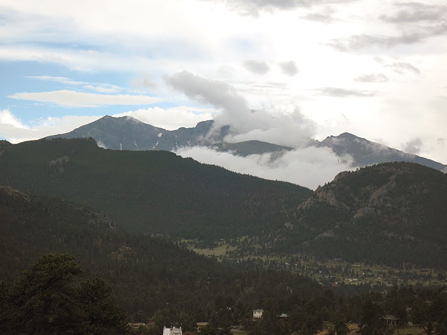
So we concluded our third trip, the last to be car-based, with a beautiful drive over Trail Ridge Road through Rocky Mountain National Park. It was an impressive drive through a beautiful place.

Forest Canyon Overlook in Rocky Mountain National Park:

The Lava Cliffs Overlook in Rocky Mtn National Park (lone hiker [tiny] visible top center):

Despite dealing with a lingering weather system that fed moist, unstable Gulf air into Colorado for almost the entire two-week duration of our adventure, we managed to gather five of our seven planned summits. All that now remains is our grand climax: eight days in the Maroon Bells-Snowmass Wilderness Area, one of Colorado's finest, and (hopefully) an ascent of beautiful Snowmass Mountain.

Pikes Peak: A Fourteen-thousand Foot Amusement Park

Pikes Peak (14,110')

length hiked: 24 miles
elevation gained: 8,400 feet

Lounging in a cafeteria, sipping coffee and gobbling greasy donuts is a different type of summit experience. Surreal and disappointing in many ways. Luxurious and pleasurable in others. Nothing in our previous twenty-one fourteeners had prepared us for it, not even the paved road and biker-swarmed bathrooms atop Mt. Evans. The Pikes Peak experience was strange enough that we all felt somehow as if we hadn't reached a summit at all, as if we'd climbed and climbed never to find the top. But we had worked hard enough, it seemed, to have earned two mountains, for we ascended over eight thousand feet and hiked twenty-four miles in two days. But something about being joined by cars, motorcycles, and a train destroyed the serene sense of accomplishment that usually accompanies a high-mountain summit.

Our long peregrination up Pikes Peak began the day before at a lowly 6,500' in the crowded streets of Manitou Springs. We trudged with fifty pound packs along the first three busy miles of the famous Barr Trail, dodging casual day hikers, runners training for the Pikes Peak marathon, and the tired ghosts (for that's all they seemed) of climbers returning from the distant summit. I admit some alarm at the sheer volume of two-legged humanoids on this part of the trail, especially for a Monday morning. But once we passed the top of the Incline Loop (an off-shoot of the Barr Trail) the crowds ceased and the slow, steady climb towards "world-famous" Pikes Peak was mercifully quiet.

Typical Barr Trail terrain:

After about six miles and almost 4,000 feet of climbing (including some up and down), we arrived at the amicable property of Barr Camp. Contrary to my prior image of Barr Camp as a mountainous tourist trap and a jarring intrusion of society on the wild, it instead presented a wonderful example of natural/human harmony in an ambrosial setting. It was a welcome scene and a place of regenerative respite, especially on a route as long and tedious as the Barr Trail. The nature-conscious owners offered open doors even to non-guests and promoted without proselytizing No Trace ethics to the many Pikes Peak visitors. They were always willing to share good conversation and entertaining mountain wisdom with any who bothered listen.

We reposed for the afternoon, observing the complex social interactions of ground squirrels quarreling over ears of corn discarded by previous, careless campers. Theresa, one of Barr Camp's benevolent owners, showed us a trick of cupping our hands around the base of her bird feeder to feel the gentle feet of hummingbirds and the subtle wind from their wings as they swooped in to feed.

Becoming a landing pad for gentle hummingbirds:

Hummingbirds jockeying for a sugar-water drink (a short video clip):

The next morning we arose at the incommodious hour of 4:00 am and engaged in a somnambulistic trek through the last hours of darkness. The silver moon was falling in front of us and the first rays of morning rose behind, giving us the sense that, depending on which way we faced, we could experience both day and night. Far below us the lights of Colorado Springs twinkled like a reflection of the nighttime sky. The pollution (usually a choking distraction to all things beautiful) exacerbated the colors of the morning, setting the sky alight with blood-orange and pink hues.

Soon after the moon vanished and morning had risen, we passed the ghosts of trees burned from a hundred-year old fire. Though Gerry Roach referred to this section as "grotesque" in his guidebook, I found it instead to be a beautiful example of the cyclical nature of death and re-birth in the wild.

The area above treeline on Barr Trail was a wonderful playground of rotund granite boulders and scraggy alpine shrubs. The trail was as quiet and peaceful as any we'd climbed on a fourteener. Still high above us we could see the summit house emerge and draw steadily nearer.

Ella and Miriam (lower left) in the area above treeline on Barr Trail:

Looking over The Cirque at around 13,300':

We convinced the only other hiker we saw in the morning to take this picture of us at The Cirque:

Finally, we reached the so-called "Golden Stairs", a 32-switchback finale to our twelve-mile climb. We used the last of our muscles to persevere through the "Golden Stairs" to reach Pikes peculiar summit.

The Golden Stairs:

The summit house of Pikes was a surreal place and an idea that I hope is never duplicated on any mountain. The true summit was a forgotten piles of boulders a hundred yards past the train station in the center of the parking lot, so, with true mountaineer spirit, we climbed a few more feet to imagine a Pikes Peak before commercialization. The detritus of numerous construction jobs dotted the landscape and the pollution that had illuminated our sunrise so vigorously now rendered any distant vista nigh impossible. It was hard not to view Pikes' summit as an extinguished, castrated place. There can be no doubt that before the chimneys of industry, and before its exploitation and commercialization, Pikes' summit was one of the most powerful and majestic mountaintops in all the American West. Much of that majesty has now been lost.

The popular picture spot atop Pikes Peak (we felt we'd earned this picture as much as anyone):

The view down Pikes' much steeper north face:

Entering the Pikes Peak summit house:

The hike down Pikes was a long and grueling ordeal. After six miles we returned to camp, broke down our tents and grudgingly re-packed our accoutrements. For the second six miles of the descent we carried the burden of fifty pounds on our backs, the price of splitting Pikes into a two-day trip. By the end we had hiked a brutal 18 miles, ascended over 4,000 feet, and descended almost eight-thousand feet (more counting the ups and downs). It was without question the most difficult single day of hiking for the summer.

So Pikes Peak is behind us, and in some ways I am split on the idea of ever returning to Barr Trail. It was a beautiful hike and a special place. But the disappointing summit is anti-climatic after so vigorous an effort. I had a wonderful experience on Pikes and wouldn't have changed anything about it. But I think should I ever feel the need to return I might just seek another, shorter route.

Saturday, July 24, 2010

Mt Bierstadt & Mt. Evans: A Tale of Two Mountains

Mt. Bierstadt (14,060') and Mt. Evans (14,264')

distance hiked: 11.06 miles
elevation gained: 3,864 feet

I'm not a fan of the overused "A Tale of Two..." allusions to Dickens famous novel, but the title seemed appropriate for this day in more ways than one. First of all, Mt. Bierstadt is a true fourteener, with a beautiful trailhead and a quiet summit, while Mt. Evans (which boasts the "highest paved road in America") has the over-exploited feel of a raucous amusement park ride. The "Tale of Two Mountains" cliche is also applicable to our experience on Bierstadt and Evans because of the two very different experiences we had: an exciting, wonderful ascent and a grueling, despairing descent. Regardless of these negatives, our experience on these two mountains was one of the most memorable climbs of the summer, and a day I wont soon forget.

The day after a relatively easy stroll up Grays and Torreys Peaks, we made it to the trailhead for Mt. Bierstadt high on Guanella Pass feeling tired but invigorated by excitement. Guanella Pass is a beautiful area, and the trailhead is at a lofty 11,669'. The lush landscape around us was socked-in by glorious tumbles of fog, and the air was crisp. The famous shape of the Sawtooth (the augural moniker for the connecting ridge between Bierstadt and Evans) loomed through the haze, looking as menacing and terrible as its namesake.

Sunrise over Mt .Bierstadt (right) and the Sawtooth:

The hike up Bierstadt was easy and relatively short. A few climbers were spread out above us, and a long line of cars/people were amassing behind. In less than three hours we achieved our first summit for the day. I quietly celebrated my twentieth fourteener.

View to the southeast from near the summit of Bierstadt (the white in the background is a thick coating of fog):

Ella finishing her ascent of Bierstadt:

View to the west toward Guanella Pass (Grays and Torreys Peaks visible in the center in the distance):

Group photo of the three of us atop Bierstadt:

After a few moments' rest, we strapped on our helmets and turned to face the most challenging portion of our day: Bierstadt's famous Sawtooth Ridge.

The view of the Sawtooth Ridge from Bierstadt:

The same photo with the route drawn in:

The Sawtooth is a renowned traverse between two popular Front Range peaks. It was also the first official Class III route of our summer. Most of what we'd heard about the route focused the difficulties and exposure of the ascent on the Sawtooth's far end (relative to Bierstadt) and said little about the descent on the near side. As a result, we were surprised to find challenging class III terrain almost immediately upon departing the summit.

The first obstacle was a steep, loose gully descending north from Bierstadt. We had to be cautious with each step not to slip or stumble or loosen rocks onto each other. Near the ridge's low point we had to traverse across an exposed face, pressing ourselves against a cliff and tiptoeing across a tiny ledge above a tall drop. At the bottom of the Tooth, we approached the crux section (the part we'd read so much about) of our day: a tall series of broken cliffs and ledges with extended class III climbing and class IV variations.

Approaching the most difficult section of the Sawtooth:

The next half-hour was exemplary of the great joys of semi-technical climbing. We had to tediously investigate our route, searching for breaks in the mountain's defenses. We had to plan ahead to avoid stranding ourselves on dead-end ledges. We had to focus on hands, feet, and rock to assure that all were working together in harmony. Each and every movement was an exercise in skill and focus. This type of climbing was a far cry from the numb ascents of solid trails that had dominated much of our fourteener experience to this point. For the first time in the summer, in many ways, we felt like true mountaineers.

The crux section of the climb:

Too quickly, we reached easier terrain, and the difficult scrambling was over. We took a short respite and scouted the next (still interesting but less technical) portion of the climb. Here the route maneuvered left onto the vertical west face of the Tooth's most jagged promontory via a narrow, gravel ledge sandwiched between tall cliffs both above and below. We watched with some trepidation as several climbers ahead of us carefully negotiated this tremendously exposed section.

Ella and Michelle resting before the last portion of the Tooth:

Our fears about this portion, it turned out, were mostly in vain as the ledge was wider and more stable than it initially appeared. The climbing did not exceed class II, and as long as we did not focus too intently on the airy drop to our left, the exposure was not problematic. This would not be a comfortable place, however, for someone afflicted with acrophobia.

Ella and Michelle negotiating The Sawtooth's narrow ledge:

Another climber overlooking a drop into oblivion:

Once past the exposed ledge we were on the west ridge of Mt. Evans, and we convinced ourselves that we had little more than a simple stroll to the summit. This stroll, however, turned out to be hotter, longer, and more tedious than anticipated. It took the better portion of an hour to accomplish.

At long last we crested the final ridge, and the view of Mt. Evans' summit opened before us. To our surprise we were greeted by the chaos of a bustling endpoint of a busy bike race. Standing abreast of the finish line was one of the race's officials, encouraging the riders with proclamations such as: "You can do it! Only a few more feet" or "You're almost there!" Her encouragement, we took the liberty of assuming, was actually meant for us.

Mt. Evan's summit and the bike race finish line:

The summit of Mt. Evans is like a different world compared to the rest of the mountain. It is, in fact, an anomaly in a sea of quiet, amazing Colorado mountaintops. A paved road achieves it. It is festooned with an observatory and summit house. It is so well equipped, in fact, that I was able to un-encumber my bladder in the relative luxury of a summit bathroom.

A mountain goat who stood by uninterested as I waited in line for the summit privy:

After lounging amongst the rocks for nearly an hour looking down on streams of bikes careening both up and down the mountain, we turned our backs on the scene of Mt. Evans' summit and began the long descent.

While undertaking this long downclimb, however, what had been one our best, most-enjoyable days of the summer took a sour turn.

The descent route (we didn't have to return over the Sawtooth) took us down an unpleasant gully that was a loose, tedious, and treacherous bowling alley of rubble and scree. We had to descend to a point lower than the trailhead and engage in the infamous Bierstadt willows (a muddy slog through bug-infested marshes and clawing, scratching brush). To complicate matters, the afternoon thunderstorms arrived on schedule, and we spent the last mile being pelted by harsh rain and stinging hail while searching for an often non-existent trail. Lightning crashed like the snarl of some great minion of Hell, and when we finally reached the car the air was statically charged with enough sufficiency to lift our hair straight from the tops of our heads.

Back at camp, foolishly thinking the worst was behind us, we were dismayed to discover four inches of hail piled against our tent and our sleeping bags resting in a pool of water several inches deep. These tribulations, however, were only a small price to pay for a great day spent teetering on the blade of a saw.

This waterfall was the only high point of an unpleasant descent:

High-alpine flowers on the slopes of Mt. Evans:

Grays and Torreys: Colorado's Quintessential Peaks

Grays Peak (14,270') & Torreys Peak (14,267')


distance hiked: 8.4 miles
elevation gained: 3,650'

In many ways Grays and Torreys Peaks are Colorado's quintessential fourteeners. An excellent trail switchbacks all the way to the summits of both peaks, the trailhead is over 11,000' and only three short miles off I-70 (Torreys Peak, in fact, can be seen by the astute motorist from I-70 just east of the Eisenhower Tunnel), they are close to the front range, and Torreys offers a variety of more challenging routes. Grays and Torreys are an excellent starting block for an aspiring mountaineer. As a result of all of these features, they are very popular mountains.

Our experience with Grays and Torreys came after a disappointing lull in our summer of climbing. For the first few weeks of our adventure we had been on a roll, averaging a fourteener just about every other day. As the summer monsoon season took full swing, however, it seemed as if we were being turned back from as many mountains as we were summiting. The weather forecast for the week of our planned Grays/Torreys hike was not good, and we had been turned away from Holy Cross only a few days before. But after laying up in Frisco to wait for a break in a slow-moving low-pressure system, we finally got our chance to climb and were rewarded with a beautiful day.

The hike up Grays/Torreys begins almost at treeline. After hiking for so long in the Sawatch Range, where most trails began around 10,000' and some as low as 8,900', this was a change that was both welcomed and strangely mourned by bot of us. Though it was nice to be able to reach a summit in a shorter amount of time, and with less effort, we had grown to cherish the moments when our trails suddenly emerged from the forest into the wide-open green spaces of the alpine tundra. It is always a magical experience, and one that often came an hour or more into our day, and after a considerable invest of effort, making it a respectable and highly anticipated reward.

Early morning sunrise on the trail to Grays & Torreys:

After a very early start we found ourselves ahead of the majority of the crowd, and after only just over two hours we reached Grays summit. It felt like a long time since we had reached a fourteener's summit (about 11 days), a testament to the amount of climbing we had accomplished this summer.

Ella having a little fun on Grays Peak's summit:

Me summiting like an Egyptian:

Looking across to Torreys Peak from Grays:

Strong winds were already gathering, so we didn't linger long before traversing over to Torreys summit, a journey that took just less than an hour. Though Grays Peak is little more than a massive pile of talus, Torreys is an interesting mountain that offers a variety of terrain, rugged southeast and northeast faces, and a beautiful summit perch. We took a moment from the top to peer down Torreys famous Kelso Ridge with its crux section, the knife edge, just below the summit. The route looked plausible and exciting, and like it would perhaps be a good place to warm up for more difficult ascents such as on Capitol Peak, or Little Bear.

Looking back on Grays from Torreys:

View north from the summit of Torreys Peak:

Our hike out from Torreys was smooth and gentle with the exception of being forced to constantly dodge the long train of people still on their way up the mountainside. Once again I was astounded to observe people beginning their hike as late as ten or eleven. Though the weather was benign enough, and the mountain easy enough, that these people were likely able to reach the summit, we were reminded the very next day of why it is crucial to being a climb on a big mountain early in the morning. But more on that later....

Tuesday, July 20, 2010

Holy Cross: Frustration in Paradise

Mt. Of the Holy Cross (14,005')

distance hiked: 8 miles
elevation gained: 3,533'

To kick-off the third part of our summer, we embarked on two-day backpack into the Holy Cross Wilderness to attempt to climb one of Colorado's most famous mountains: Mt. Of the Holy Cross. Holy Cross takes its name from an inset couloir that splits the mountain's rugged north face. This tall shaft of snow is bisected at perfect height and angle by a sharp ledge to form a snowy impression of the Holy Rood. This dramatic image has given birth to one of Colorado's most iconic natural symbols. Holy Cross, though a bit removed from the others, is considered part of the Sawatch Range: it is the Sawatch's northernmost fourteener. Coincidentally, Mt Shavano (the Sawatch's southernmost fourteener) is home to the Angel of Shavano. It is interesting that the Sawatch Range is bookended by mountains of spiritual/religious significance. Regardless of religious faith, the Holy Cross Wilderness is a place of such intense beauty and power that it would undoubtedly stir the hearts and souls of even the most cynical skeptic.

The busy trailhead had us expecting heavy crowds. The trail, however, was relatively quiet in comparison:

The first part of our hike consisted of a climb up and over Halfmoon Pass. Immediately upon departing from our car at the busy trailhead, we were besieged by a grueling combination of heat and mosquitoes. With fifty pounds of gear resting upon our shoulders, the three-mile, fifteen-hundred foot climb was a rugged test of perseverance and conditioning.

At the summit of Halfmoon Pass, beautiful vistas opened of the East Cross Creek drainage, and we tried to guess which of the peaks rising to the south were part of the Holy Cross Massif. The pass was just shy of timberline, and a chilly wind groped with cold tendrils at our sweat-soaked skin.

After a brief hiatus we began the thousand-foot descent to our destination as tall, dark storms accumulated on the surrounding ramparts of the northern Sawatch Range. About a half mile in we were greeted with our first, breathtaking view of Mt. Of the Holy Cross when its rugged northwest face appeared suddenly through the trees. The view was neck-bending and imposing. A few switchbacks later we found ourselves looking down on the dramatic depths of the East Cross Creek Basin.

I will never forget that first view of the basin at the foot of Colorado's holiest mountain. No guidebook description or photograph had prepared me for its majesty. The whole valley seemed like a great bowl of granite angles and cliffs. Imposing walls adorned with a lush green wardrobe of pines and aspens framed the crystalline streak of a stair-stepping waterfall. The upraised thumb of Holy Cross Mountain stood tall over everything like a benevolent sentry. We both remarked that, without a doubt, this was the most beautiful place we'd seen yet in Colorado.

Holy Cross and the East Cross Creek Basin (the cross itself is not visible from this vantage):


Close-up of the waterfall (the small appearance in the picture of this huge waterfall gives an idea of the scope of this valley):


After dropping into this Eden, we set-up camp on a beautiful site surrounded by amicable trees and a base of velveteen sand and leaves. The chorus of rushing waters from the nearby creek, a sound omnipresent on our previous three week adventure but depressingly absent during our week in town, provided a soothing backdrop.

After lounging for an hour or two in our hammocks, we set-out to investigate this veritable playground. For the next two hours we played like children, discovering convoluted granite canyons with S-turn rapids, pristine pools with every detail of their cobbled bottoms strikingly visible, and talus fields festooned by ribbons of cold water. We scrambled up the eastern end of the valley to the last few steps of the mighty waterfall we'd seen earlier from above and lounged on a rock in contemplation as the skies above cleared and a magnificent, blue-sky evening took shape. We could explore this place for days and days and barely nick the surface of all Holy Cross has to offer.

Moonrise over Granite escarpments:

Quiet contemplation in paradise:

That night, however, we found our sleep troubled as our minds struggled to re-adapt to the challenges of wilderness life. Rain knocked on the top of our tent, humidity made us sticky in our sleeping bags, and our bodies emanated an unpleasant combination of mosquito repellent and sweat. When the alarm pulled us from our "sleep" neither one of us could boast more than a few hours of good rest.

The clear skies from the evening before had been replaced by a grim layer of clouds, and we couldn't help but feeling from the very outset that it was unlikely we would reach our summit. We attempted to the climb anyway, despite the weather, and were rewarded with a magnificent sunrise that painted the clouds a vast palette of reds, oranges, and purples. By treeline, however, shafts of rain had all but overtaken our paradise, and we were forced (once again) to turn around short of our goal. Only a few minutes later rain began tumbling from the sky, and we could see a dark shroud woven around Holy Cross's summit.

A dramatic sunrise provides a magical moment on an otherwise frustrating morning:

Rainclouds overtaking the valley and chasing us off the mountain:

We returned to camp disappointed and napped for an hour or two through the storm. When we awoke, the rain had broke and the clouds were scattering. Tufts of blue sky spread until, by the time we had dismantled our camp, blue sky dominated the view as far as our eyes could see. We couldn't believe our misfortune and bad timing, and considered briefly renewing our ascent. Our energy stores for the day, however, were low, and we still had a difficult return trip up and over Halfmoon Pass.

On the way out we reached that magical overlook where we had first laid eyes on the valley. The good weather was vanishing and clouds were once again roiling high into the heavens. There was some disappointment that we hadn't made our summit, but it was hard to feel too upset. Failing to reach Holy Cross's summit was, ultimately, a small price to pay for spending two days in one of Colorado's most magical places. We knew we would have to return and give this place the time and attention it truly deserves.

Wednesday, July 14, 2010

Mt. Elbert: Roof of the Rockies

Mt. Elbert (14,433')

miles hiked: 9.2
elevation gained: 4,685 feet

A fitting climax to our three-week tour of the Sawatch Range was to climb the tallest mountain in the range and the entire state of Colorado: Mt. Elbert. After a week long stretch of gnarly weather, we hoped, as we watched a tall storm build to the west of us the night before, for respite and some much-deserved blue skies.

Mt. Elbert is the roof of the American Rockies. It is the tallest point in the Rocky Mountains within the contiguous United States and second tallest in the lower 48 behind only the Sierra Nevada's Mt. Whitney (14,505'). We had the privilege of being joined for the climb by Outward Bound guide/climber/alpinist/adventurer/writer extraordinaire Cisco Tharpe. As will always be the case, it is a treat having good company for a good mountain.

Ella and Cisco almost at treeline:

Our climb up Elbert was quite special. We didn't let high winds or the winter-reminiscent chill blunt our spirits. We hit the trail early and climbed steadily. The last thousand feet to the summit were plagued by some of the strongest wind and coldest weather of the season, second only to our now-infamous day on Mt. Lincoln. Ella remarked, as we persevered, that she felt like a "dog with its head out the window, unable to get a full breath".This description seemed particularly apt.

From about 13,000' looking towards the summit:

When we reached the summit, we hid behind a pile of rocks from the wind and snacked on our food, enjoying unbelievable vistas in all directions. Mt. Massive loomed to the north, mocking us for not making its summit two days earlier. Our old friend La Plata (my first 14er) towered dramatically to the south. Its dramatic Ellingwood Ridge was jagged and impressive under a fresh glaze of July snow. To the west we could see the distinct skyline of the Elk Range. Snowmass Mountain, a two-pronged thrust, was particularly impressive as it was the only peak visible in any direction still white as winter.

View of Halfmoon area and Mt. Massive from the summit:

View to the south of beautiful La Plata:

Three's Company:

A short, windy video clip from the summit:

Not far behind us came a man with a particularly wind-blown look on his face. We asked him amicably how things were going, and he growled in response: "Pretty godd(pg.13)mn sh(pg.66)ty." He went on to complain in all seriousness that he was sure he had climbed the wrong mountain because there were several peaks nearby that looked taller. He pointed to Massive and La Plata as examples. We told him the elevations of all these peaks. Despite our assurances that he was indeed standing upon the highest point in Colorado, he persisted being furious that Elbert didn't seem like the tallest. I suppose he didn't understand that when you are talking about twelve feet (in the case of Massive) perspective can be deceiving.

A sparkling lake viewed on descent (this picture just doesn't quite capture it):

On the way down we felt much more playful with the wind. On switchbacks that faced it head-on we'd laugh and sing into it in defiance. On switchbacks where it was at our backs we'd spread our arms like airplanes or see how far we could jump. We'd try to find appropriate Caddyshack or Big Lebowski quotes for the moment. Embracing the wind, we decided, is the only way to keep it from taking over your day. We passed many grumpy people, however, still on their way up who hadn't discovered this strategy.

So ended our second, and longest, trip of the summer. We still have two more to go: a Front Range adventure in which we will try to collect Holy Cross, Grays, Torreys, Evans, Bierstadt, Pikes, and Longs; and a culminating backpack trip in which we intend to climb Snowmass Mountain and spend a week lolling about in the majesty of the Maroon Bells-Snowmass Wilderness Area. Though we haven't climbed all the mountains we intended (12 out of 19 to this point), and expect it is quite likely we wont make every summit still ahead, we have had a beautiful summer and forged memories that will undoubtedly last a lifetime. The high country is an exotic and magical place. When you enter it with the reverence and respect that it deserves, you will come out wiser and stronger as a result.

Summer of 14ers totals (1 month):

distance hiked: 114.44 miles
elevation gained: 50,479 feet

With training month included:

distance hiked: 202.61 miles
elevation gained: 81,270 feet